Hike from Rina/Welschellen to Lake of Rina

San Vigilio - San Martin
Add to favourites
Difficulty
Intermediate
Duration
2:20
in hours
Distance
5.4
in km
Status
closed

LAKE OF RINA (2180 m, H-R 5 h)
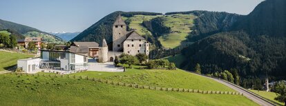
From the sports ground in Rina a 1- 1.5 hour walk on a signed path takes you to the hut Munt da Rina (refreshments available). The path continues via Col dal Lè all the way to the idyllic Lake of Rina. Return is via the same route.

Route data
Intermediate
Distance
5,4 km
Duration
2 h 20 min
Ascent
671 m
Decent
33 m
Technical skills
Physical condition
Scenary
Highest point
2.175 m
Lowest point
1.505 m
How to get there
By express highway Rosenheim-Kufstein-Innsbruck-Brenner up to exit "Brixen", where you continue toward the Pustertal (Val Pusteria). After about 20 km on the Pustertal na-tional road, always heading toward Bruneck, you turn off to your right just before St. Lorenzen, into the Gadertal, heading towards Alta Badia. The SS244 carries you up to Rina/Welschellen.
You might be interested in
Discover related tours
San Vigilio - San Martin
Theme walk: Tres la Val
Distance 13,7 km
Duration 4 h 03 min
Ascent 497 m
Decent 57 m
Status
closed
Fanes pasture | © Obwegs Carlo, St. Vigil in Enneberg
Intermediate
Add to favourites
San Vigilio - San Martin
Summer hike to the Gran Fanes pastures
Distance 7,7 km
Duration 2 h 46 min
Ascent 680 m
Decent 122 m
Status
closed
San Vigilio - San Martin
Lungiarü to the Val di Murins
Distance 1,7 km
Duration 2 h 00 min
Ascent 159 m
Decent 5 m
San Vigilio - San Martin
Summer hike to Santa Croce / Heiligkreuz
Distance 11,9 km
Duration 4 h 37 min
Ascent 1.256 m
Decent 440 m
Status
closed
View from Ju | © Ass. Turistica San Martin, St. Vigil in Enneberg
Intermediate
Add to favourites
San Vigilio - San Martin
Hike from San Martin across Piculin and Gran Jú to Col dl'Ancona
Distance 4,7 km
Duration 1 h 54 min
Ascent 530 m
Decent 47 m
Peitlerkofel | © Ass. turistica San Martin, St. Vigil in Enneberg
Intermediate
Add to favourites
San Vigilio - San Martin
Passo delle Erbe - Peak Putia
Distance 5,7 km
Duration 3 h 03 min
Ascent 936 m
Decent 52 m
Status
closed