

Lungiarü to the Val di Murins

San Vigilio - San Martin
Add to favourites
Category
Difficulty
Easy
Duration
2:00
in hours
Distance
1.7
in km
Status
closed
Suggested period
Jan
Feb
Mar
Apr
May
Jun
Jul
Aug
Sep
Oct
Nov
Dec

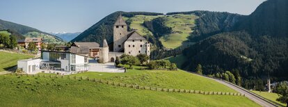
From the church in Longiarü, head south-west towards Frëina/Seres along the road until you reach the bridge. From there, a small path leads through the forest to Frëina. Follow the paved road on the right and, in the bend after the bridge, take the narrow path on your left. Walk past the Vanc farmstead to the hamlet Seres, a lovely example of the extraordinary historic Viles. Val di Murins, the valley of the mills, opens up just before the bridge over the stream.

Route data
Easy
Distance
1,7 km
Duration
2 h 00 min
Ascent
159 m
Decent
5 m
Physical condition
Scenary
Highest point
1.718 m
Lowest point
1.393 m
You might be interested in
Discover related tours
San Vigilio - San Martin
Summer hike: Lungiarü - Val di Murins - Genova Inn - Sasso Putia
Distance 9,7 km
Duration 4 h 53 min
Ascent 1.470 m
Decent 53 m
Status
closed
Ciastlins | © Obwegs Carlo, St. Vigil in Enneberg
Intermediate
Add to favourites
San Vigilio - San Martin
Summer hike to Ciastlins
Distance 3,6 km
Duration 2 h 13 min
Ascent 710 m
Decent 5 m
Status
closed
San Vigilio - San Martin
Walk: Brüscia
Distance 2,8 km
Duration 47 min
Ascent 62 m
Decent 82 m
Meadows of Sas de Pütia | © TV San Vigilio-San Martin, St. Vigil in Enneberg
Intermediate
Add to favourites
San Vigilio - San Martin
Antermoia - Passo delle Erbe - Pütia Meadows
Distance 5,5 km
Duration 2 h 09 min
Ascent 588 m
Decent 44 m
Ciastlins | © Obwegs Carlo, St. Vigil in Enneberg
Intermediate
Add to favourites
San Vigilio - San Martin
Summer hike: around Monte Paracia
Distance 16,7 km
Duration 5 h 48 min
Ascent 1.265 m
Decent 1.265 m
Status
closed
On the mountain | © Associazione Turistica San Martin de Tor, St. Vigil in Enneberg
Intermediate
Add to favourites
San Vigilio - San Martin
Summer hiking: Passo delle Erbe - Forcella de Pütia - Rifugio Genova
Distance 5,9 km
Duration 2 h 02 min
Ascent 453 m
Decent 141 m
Status
closed