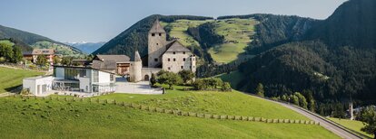


Walk: San Vigilio - Passo Furcia

San Vigilio - San Martin
Add to favourites
Category
Difficulty
Easy
Duration
1:59
in hours
Distance
5.3
in km
Suggested period
Jan
Feb
Mar
Apr
May
Jun
Jul
Aug
Sep
Oct
Nov
Dec

Walk past the Miara cable car station and follow the road up to the hamlet Rara. Turn right onto forest path no. 1 which takes you to Passo Furcia, where a number of inns offer food and drinks. Take the same route to walk back. Alternatively to walking on the paved road, just behind the Chi Vai restaurant you can also take the pretty hiking trail which leads past the Riffa inn. After passing the eadows, you will find the path to the Spaces restaurant (stop here for food, drinks and a sun deck) on the left side at the edge of the forest. This route leads back to the main path (no. 1).

Route data
Easy
Distance
5,3 km
Duration
1 h 59 min
Ascent
533 m
Decent
11 m
Physical condition
Scenary
Highest point
1.746 m
Lowest point
1.218 m
You might be interested in
Discover related tours
Ciastlins | © Obwegs Carlo, St. Vigil in Enneberg
Intermediate
Add to favourites
San Vigilio - San Martin
Summer hike to Ciastlins
Distance 3,6 km
Duration 2 h 13 min
Ascent 710 m
Decent 5 m
Ciastlins | © Obwegs Carlo, St. Vigil in Enneberg
Intermediate
Add to favourites
San Vigilio - San Martin
Summer hike: around Monte Paracia
Distance 16,7 km
Duration 5 h 48 min
Ascent 1.265 m
Decent 1.265 m
Panorama | © Skriama Kronplatz, Bruneck Kronplatz Tourismus
Intermediate
Add to favourites
San Vigilio - San Martin
Piz de Plaies > San Vigilio
Distance 3,8 km
Duration 1 h 30 min
Ascent 13 m
Decent 439 m
Status
closed
San Vigilio - San Martin
Didactic path: Tru Vistles
Distance 3,5 km
Duration 56 min
Ascent 64 m
Decent 64 m
San Vigilio - San Martin
Hike from Picolin across Plaies - Longega and back
Distance 5,3 km
Duration 1 h 31 min
Ascent 162 m
Decent 309 m
San Martin de Tor | © Ass. Turistica San Martin, St. Vigil in Enneberg
Intermediate
Add to favourites
San Vigilio - San Martin
Hike from San Martin across Lovara - Costa to La Val / Wengen
Distance 7,6 km
Duration 2 h 26 min
Ascent 438 m
Decent 223 m