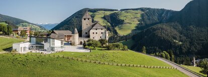
Summer hike: Lungiarü - Muntcörta - Antersasc - Puez Inn

San Vigilio - San Martin
Add to favourites
Category
Difficulty
Intermediate
Duration
3:27
in hours
Distance
6.8
in km
Suggested period
Jan
Feb
Mar
Apr
May
Jun
Jul
Aug
Sep
Oct
Nov
Dec

Follow forest road No. 9 through the forest until you reach the Antersasc alpine pasture. From here, climb northwards to Crëp dales Dodesc. For the Puez hut, walk to the end of the meadow, where an uphill path leads past the gorge. After a short descent, you will reach the Rifugio Puez inn which offers food, drinks and accommodation.

Route data
Intermediate
Distance
6,8 km
Duration
3 h 27 min
Ascent
1.042 m
Decent
64 m
Physical condition
Scenary
Highest point
2.519 m
Lowest point
1.501 m
You might be interested in
Discover related tours
Piz de Plaies | © CT San Vigilio/San Martin, St. Vigil in Enneberg
Intermediate
Add to favourites
San Vigilio - San Martin
Hike around Piz de Plaies
Distance 3,8 km
Duration 1 h 30 min
Ascent 177 m
Decent 177 m
Antersasc | © Ass. turistica San Martin, St. Vigil in Enneberg
Intermediate
Add to favourites
San Vigilio - San Martin
Summer hike: Lungiarü - Muntcörta - Antersasc - Crep dales 12
Distance 6,2 km
Duration 3 h 01 min
Ascent 901 m
Decent 21 m
Meadow | © Ass. turistica San Martin de Tor, St. Vigil in Enneberg
Intermediate
Add to favourites
San Vigilio - San Martin
Summer hike: Antermoia - Alfarëi - Forcella de Lijun - Rina Lakes
Distance 4,7 km
Duration 2 h 13 min
Ascent 659 m
Decent 15 m
San Vigilio - San Martin
Hike from Picolin across Plaies - Longega and back
Distance 5,3 km
Duration 1 h 31 min
Ascent 162 m
Decent 309 m
Pice Ju | © Obwegs Carlo, St. Vigil in Enneberg
Intermediate
Add to favourites
San Vigilio - San Martin
Hike around Pice Ju
Distance 2,7 km
Duration 1 h 15 min
Ascent 140 m
Decent 140 m
Ütia de Göma | © Ass. turistica San Martin, St. Vigil in Enneberg
Intermediate
Add to favourites
San Vigilio - San Martin
Summer hike: Antermoia - Al Bagn Valdander - Ütia de Göma hut - Passo delle Erbe
Distance 6,9 km
Duration 2 h 43 min
Ascent 750 m
Decent 234 m